Changing Channels
It’s been a few weeks since the flood of 2025. Is that what we are calling it? For our local watersheds, the Sandy and Clackamas were the third-highest recorded, bumping 2011 into fourth after the ‘64 and ‘96 floods.
I might have mentioned this before, but I lived on the Sandy for both the 2011 and ‘96 floods. 2011 was the most impactful year for my fishing, and I remember very well how eye-opening it was seeing those changes.
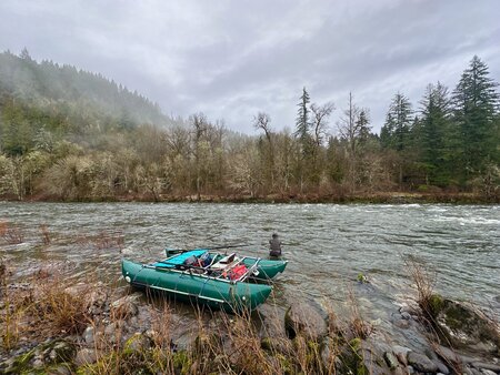
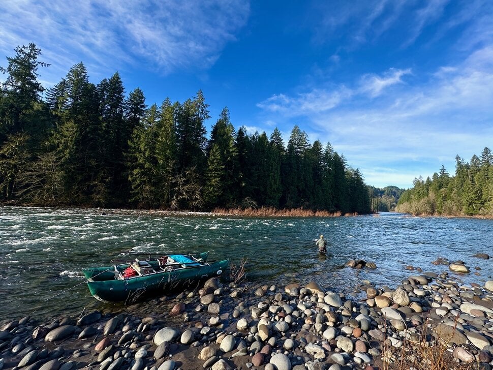
I’ve been on the Sandy for a few days and have floated from Dodge to Oxbo and all the way to Dabney. So basically covering the majority of the fishing water.
The most impactful thing that most people will see is the Oxbo boat ramp. It has essentially been washed away. When that boat launch was put in the water was right up against it. There was a disabled fishing platform that was right on the water. But over the last 25 or so years, the river has moved so that the platform is about 100’ from the water. Well, now the river is back to where it was. The water was so high that it was up on the turnaround above the tree in the turnaround. It’s also noticeable that if you’re parked up on top about 5-10 feet along the edge of the parking lot, it fell in with a sizable chunk of the bank.
On the first day, I put in at Dodge. I immediately noticed that, with the high water running over the island at the boat launch, the channel is about 10’ narrower than it has been. Making it skinnier and faster right where you put the boat in. As a visual note, the river was up around the picnic table that’s right next to the boat launch.
Once we floated away from the boat launch, we were on a scavenger hunt. What’s new and what’s gone. The first big change was a run that we call the yellow canoe, which has filled in and is very shallow halfway across the river. I guess that’s gone. Hopefully, for every run lost, one is gained.
This river rebirth is one of my favorite things. All the new possibilities, it’s like springtime, where everything is fresh again. Looking for where channels are carved out and made deep again. What’s filled in, and where are the new channels? The dog's head hole is covered up, and the Christmas tree is deep and slow along the bank.
Where are we going to find secret fish buckets?
One of the many cool things that Randy Stetzer showed me was a feature on the Google Earth app. On the app, there is a feature that shows historical imagery. You can go to the river, zoom in, and click through the years to see how the river has changed. I think it’s fun to look back and see how the river has changed. Runs that we have lost, like last chance and the Collins riffle, and ones that have developed, like the I don’t know hole, or warchild or dog head. You need to go out and explore these new rivers in your backyard and find your new run. Just keep your eyes open, and be careful out there!
Leave a comment
Recent articles
View all
Twitchy Twitchy
The Stag